Learn more about GPS
How we survey from the sky
The original space-based navigation system was called TRANSIT -> first launched in 1960... for the military only. In 1978 the United States Air Force launched the fledgling "Navstar" system, which would eventually become known as the Global Positioning System, better known today as "GPS." Since those early days, many more systems have been launched into space by many other countries, adding to the constellation of "birds" in the sky.
By incorporating the newest technology, we at Bryan L. Bailey Associates, Inc. are able to use the following systems to improve our locational precision:
- GPS (United States)
- GLONASS (Russian)
- Galileo (European Union)
- Beidou (Chinese System)
GNSS stands for Global Navigation Satellite System, and is comprised of all the available satellites overhead at any given time.
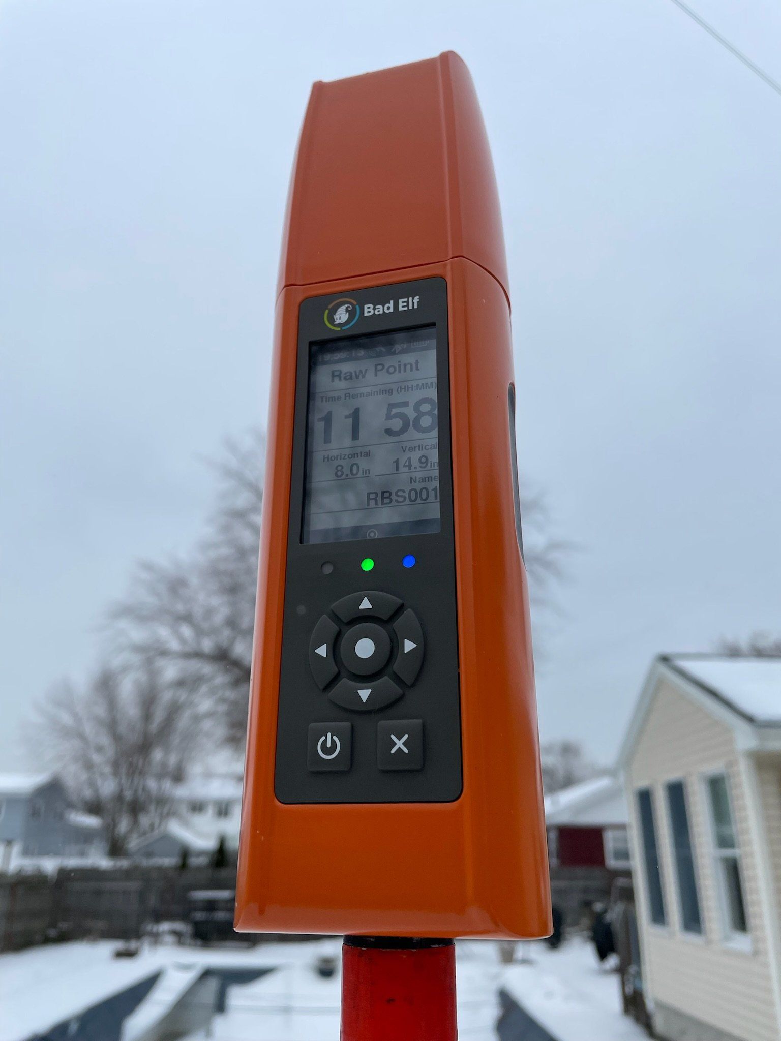


Our current system
We are early adopters of the Bad-Elf GNSS system. I'll be describing our work flows and solutions that we have provided.